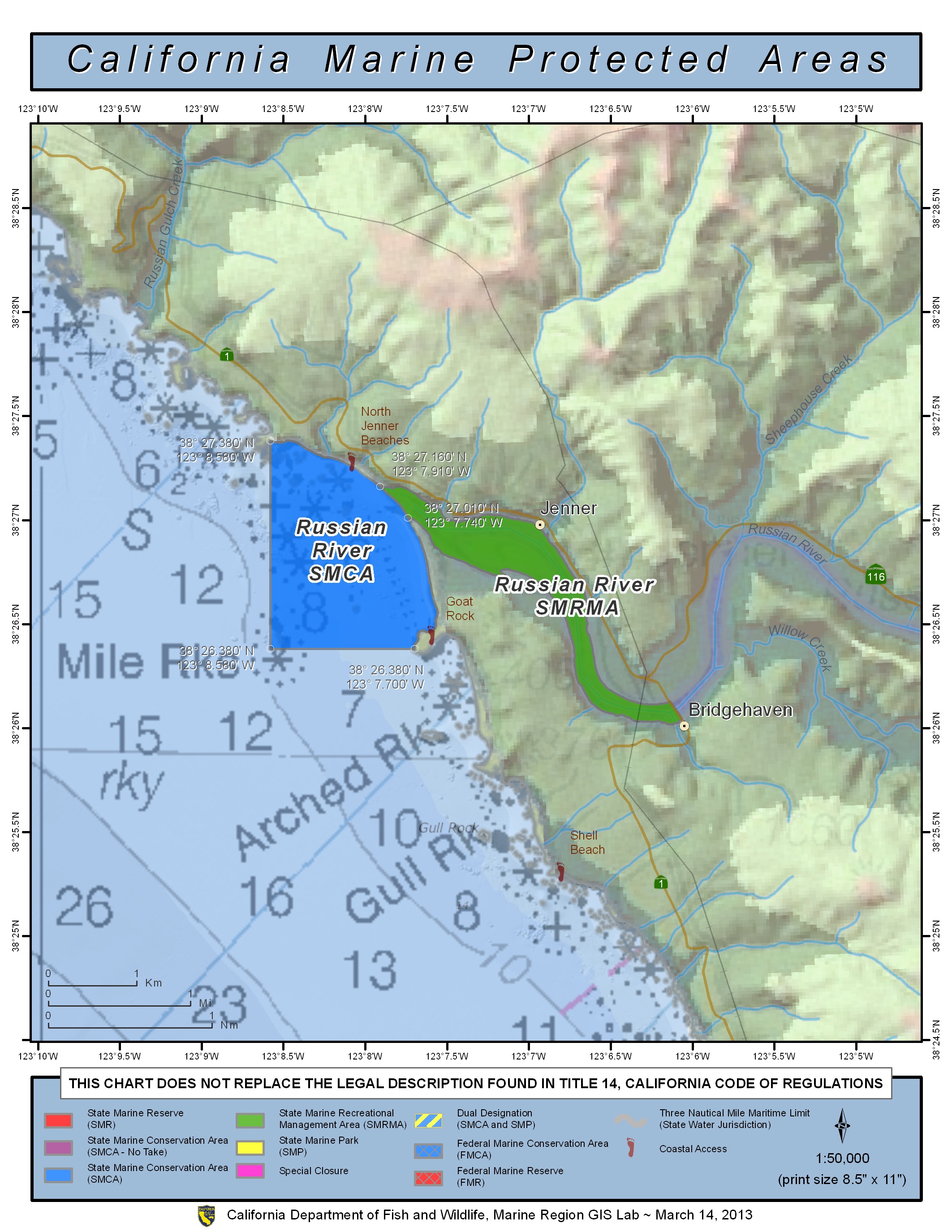
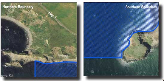
Shoreline Boundary Landmarks:
Coming soon!
GPS Boundary:
This area is bounded by the mean high tide line, the mouth of the Russian River estuary as defined in subsection 632(b)(14)(A), and straight lines connecting the following points in the order listed:
38° 27.38′ N. lat. 123° 08.58′ W. long.;
38° 26.38′ N. lat. 123° 08.58′ W. long.; and
38° 26.38′ N. lat. 123° 07.70′ W. long.
Permitted/Prohibited Uses:
- Recreational Fishing:
- Allowed Species: Dungeness crab by trap and surf smelt by hand dip net or beach net.
- Prohibited Species: All other living marine resources EXCEPT those listed above.
- Commercial Fishing:
- Allowed Species: Dungeness crab by trap.
- Prohibited Species: All other living marine resources EXCEPT those listed above
Effective as of: May 1, 2010
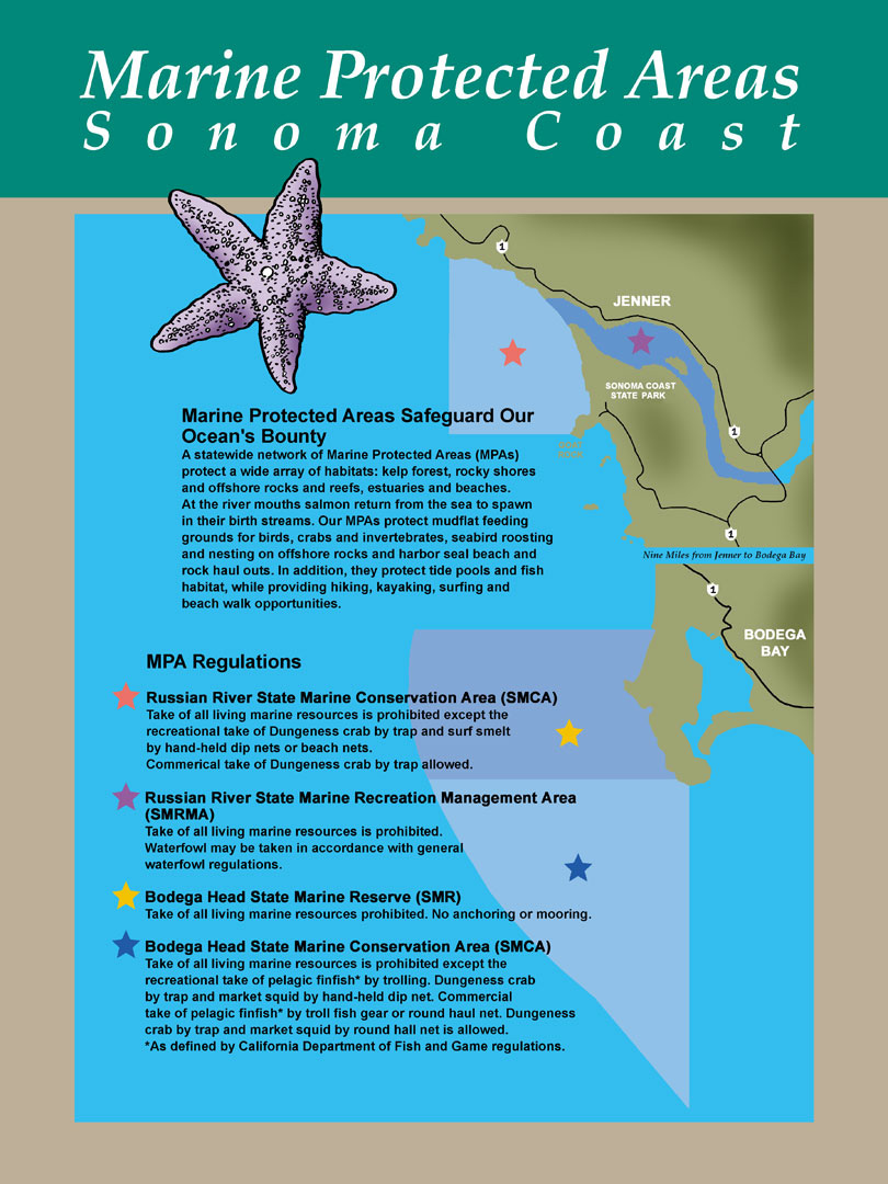
Additional Resources:
- Brochure: Russian River Brochure
- Interpretive Panel: Russian River Jenner MPA
- Cool Facts: Visit Russian River
- Sonoma Coast MPA Display– Stewards of the Coast and Redwoods
- Exploring California’s Marine Protected Areas: Russian River State Marine Recreational Management Area, and Russian River State Marine Conservation Area (CDFW)