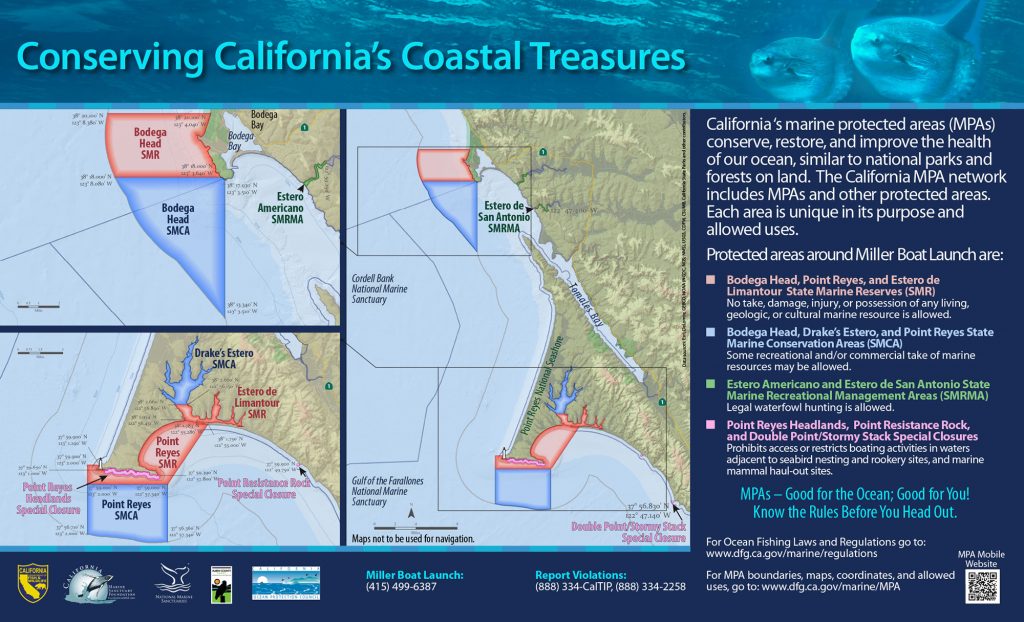
GPS Boundary:
On the south side of the Point Reyes Headlands from the mean high tide line to a distance of 1000 feet seaward of the mean lower low tide line of any shoreline between lines extending due south from each of the following two points:
37° 59.65′ N. lat. 123° 01.00′ W. long; and
37° 59.39′ N. lat. 122° 57.80′ W. long
Permitted/Prohibited Uses:
- Recreational Fishing
- Allowed Species: None
- Prohibited Species: All
- Commercial Fishing
- Allowed Species: None
- Prohibited Species: All
Other Regulations:
No person shall enter the area, except for agencies identified in Title 14 Section 632 CCR, when performing their official duties.
