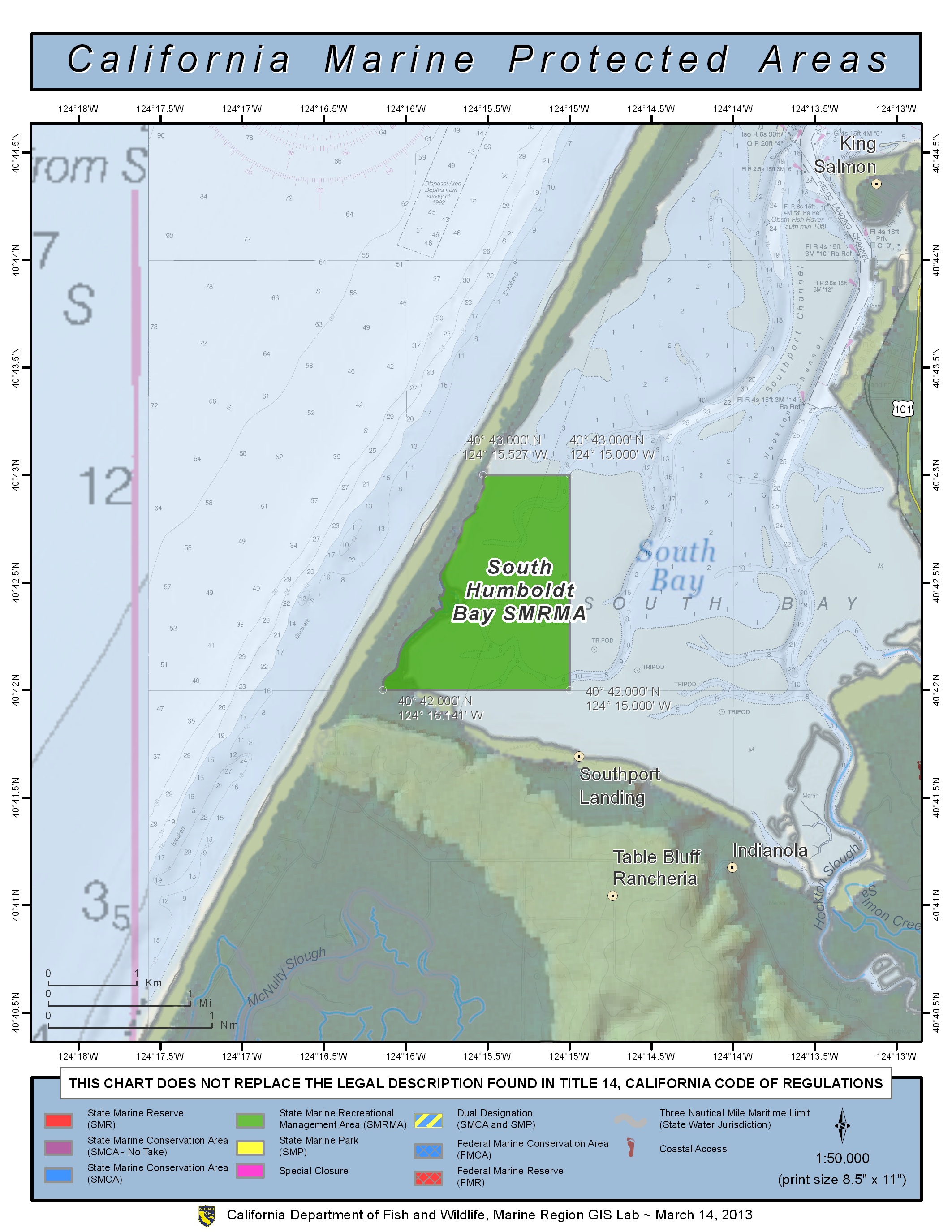
GPS Boundary:
This area is bounded by the mean high tide line and straight lines connecting the following points in the order listed except where noted:
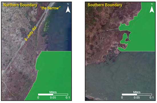
40° 43.000′ N. lat. 124° 15.527′ W. long.;
40° 43.000′ N. lat. 124° 15.000′ W. long.;
40° 42.000′ N. lat. 124° 15.000′ W. long.; and
40° 42.000′ N. lat. 124° 16.141′ W. long.
Permitted/Prohibited Uses: *
- Recreational Fishing:
- Allowed Species: None
- Prohibited Species: All
- Commercial Fishing:
- Allowed Species: None
- Prohibited Species: All
* The following federally recognized tribe is exempt from the area and take regulations for South Humboldt Bay State Marine Recreational Management Area (subsection 632(b)(9)) and shall comply with all other existing regulations and statutes: Wiyot Tribe
Waterfowl may be taken in accordance with the general waterfowl regulations (Sections 502, 550, 551, and 552).
Effective as of: December 19, 2012
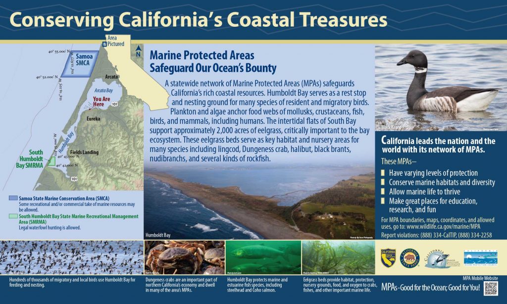
Additional Resources:
- Humboldt Bay Interpretive Panel
- Humboldt Bay Harbor Sign
- Humboldt Bay Harbor Brochure
- Reading Rock to Mattole MPA Map
- South Humboldt Bay SMRMA Overview Sheet
- Cool Facts: South Humboldt Bay
- Exploring California’s Marine Protected Areas: South Humboldt Bay State Marine Recreational Management Area (Part One) CDFW
- Exploring California’s Marine Protected Areas: South Humboldt Bay State Marine Recreational Management Area (Part Two) CDFW