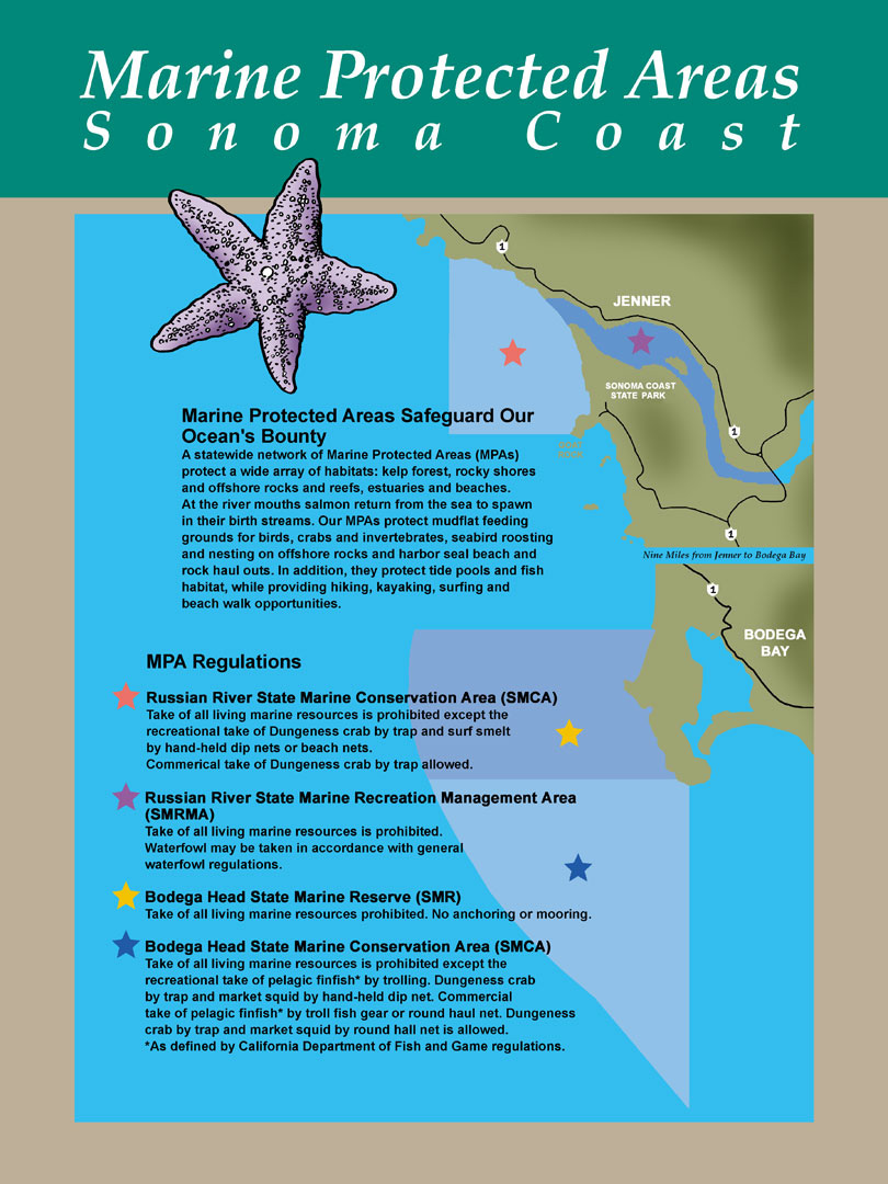
Shoreline Boundary Landmarks:
Coming soon!
GPS Boundary:
This area is bounded by the mean high tide line and straight lines connecting the following points in the order listed except where noted:
38° 20.10′ N. lat. 123° 04.04′ W. long.;
38° 20.10′ N. lat. 123° 08.38′ W. long.;
thence southward along the three nautical mile offshore boundary to
38° 18.00′ N. lat. 123° 08.08′ W. long.; and
38° 18.00′ N. lat. 123° 03.64′ W. long.
Permitted/Prohibited Uses:
- Recreational Fishing:
- Allowed Species: None
- Prohibited Species: All
- Commercial Fishing:
- Allowed Species: None
- Prohibited Species: All
Effective as of: May 1, 2010
Additional Resources:
- Brochure: Russian River Brochure
- Interpretive Panels:
- Cool Facts: Visit Bodega Bay
- Sonoma Coast MPA Display– Stewards of the Coast and Redwoods