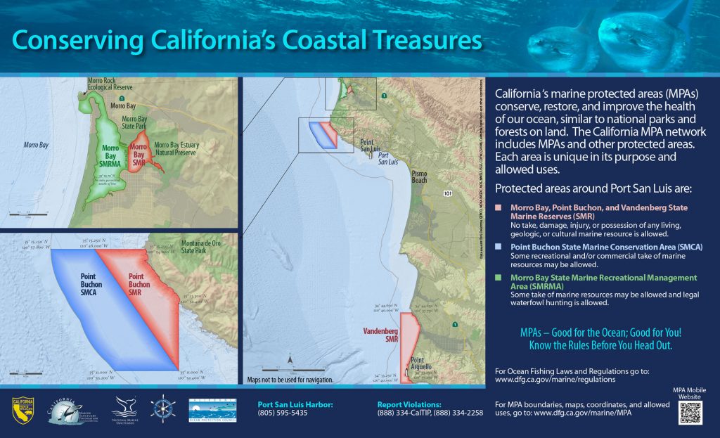
GPS Boundary:
This area is bounded by the mean high tide line and straight lines connecting the following points in the order listed:
35° 15.25′ N. lat. 120° 54.00′ W. long.;
35° 15.25′ N. lat. 120° 56.00′ W. long.;
35° 11.00′ N. lat. 120° 52.40′ W. long.; and
35° 13.30′ N. lat. 120° 52.40′ W. long.
Permitted/Prohibited Uses:
- Recreational Fishing:
- Allowed Species: None
- Prohibited Species: All
- Commercial Fishing:
- Allowed Species: None
- Prohibited Species: All
Effective as of: September 21, 2007