Shoreline Boundary Landmarks:
Coming soon!
GPS Boundary:
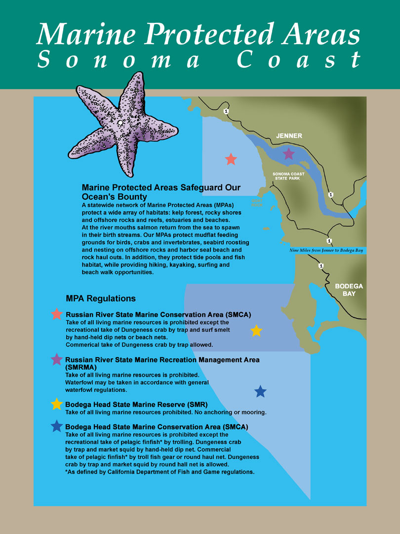
This area includes the waters below the mean high tide line eastward of the mouth of the Russian River Estuary defined as a line connecting the following two points:
38° 27.16′ N. lat. 123° 07.91′ W. long.; and
38° 27.01′ N. lat. 123° 07.74′ W. long.
and westward of the Highway 1 Bridge.
- Recreational Fishing:
- Allowed Species: Hunting of waterfowl unless otherwise restricted by hunting regulations.
- Prohibited Species: All other living marine resources EXCEPT those listed above.
- Commercial Fishing:
- Allowed Species: None
- Prohibited Species: All
Effective as of: May 1, 2010
Additional Resources:
- Brochure: Russian River Brochure
- Interpretive Panel: Russian River Jenner MPA
- Cool Facts: Visit Russian River
- Sonoma Coast MPA Display– Stewards of the Coast and Redwoods
- Exploring California’s Marine Protected Areas: Russian River State Marine Recreational Management Area, and Russian River State Marine Conservation Area (CDFW)

