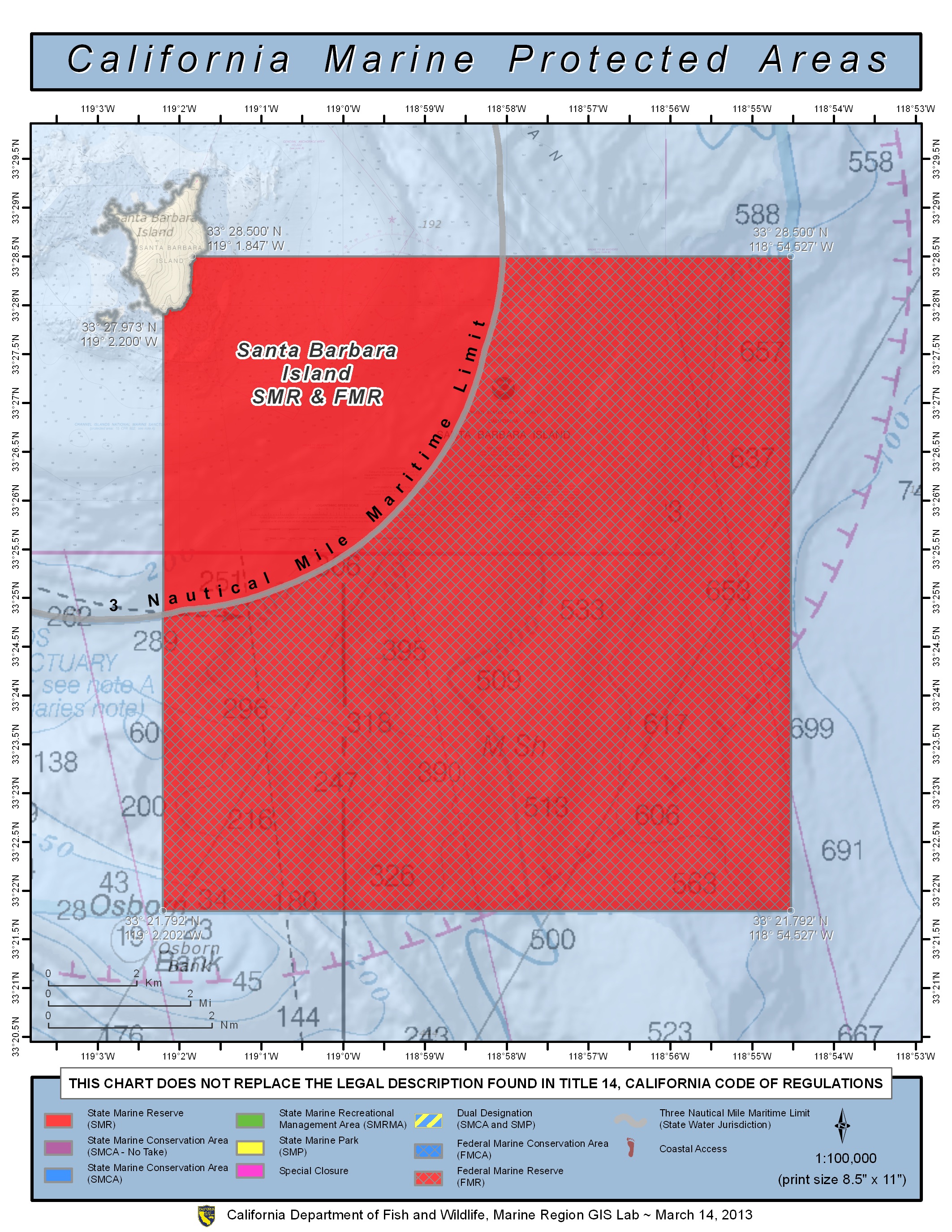
GPS Boundary:
This area is bounded by the mean high tide line and straight lines connecting the following points in the order listed except where noted:
33° 28.500’N. lat. 119° 01.847’W. long.;
33° 28.500’N. lat. 118° 58.051’W. long.; thence along the three nautical mile offshore boundary to
33° 24.842’N. lat. 119° 02.200’W. long.; and
33° 27.973’N. lat. 119° 02.200’W. long.
Federal MPA boundary corner coordinates:
(Textual boundary descriptions and related regulations are available in the Federal Register 15 CFR Part 922 and 50 CFR Part 660).
33° 21.792′ N. lat., 118° 54.527′ W. long.
33° 21.792′ N. lat., 119° 02.200′ W. long.
33° 25.008′ N. lat., 119° 02.200′ W. long.
33° 28.500′ N. lat., 118° 58.248′ W. long.
33° 28.500′ N. lat., 118° 54.527′ W. long.
Permitted/Prohibited Uses:
- Recreational Fishing:
- Allowed Species: None
- Prohibited Species: All
- Commercial Fishing:
- Allowed Species: None
- Prohibited Species: All
Effective as of: January 1, 2012