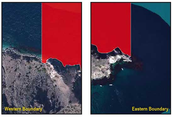
GPS Boundary:
This area is bounded by straight lines connecting the following points in the order listed except where noted:
33° 24.38′ N. lat. 118° 21.98′ W. long.;
33° 25.50′ N. lat. 118° 21.98′ W. long.;
33° 25.50′ N. lat. 118° 24.00′ W. long.; and
33° 25.11′ N. lat. 118° 24.00′ W. long.
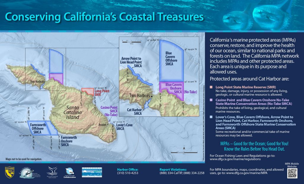
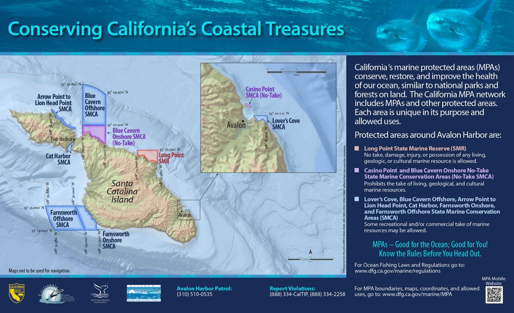
Permitted/Prohibited Uses:
- Recreational Fishing:
- Allowed Species: None
- Prohibited Species: All
- Commercial Fishing:
- Allowed Species: None
- Prohibited Species: All
Effective as of: January 1, 2012
