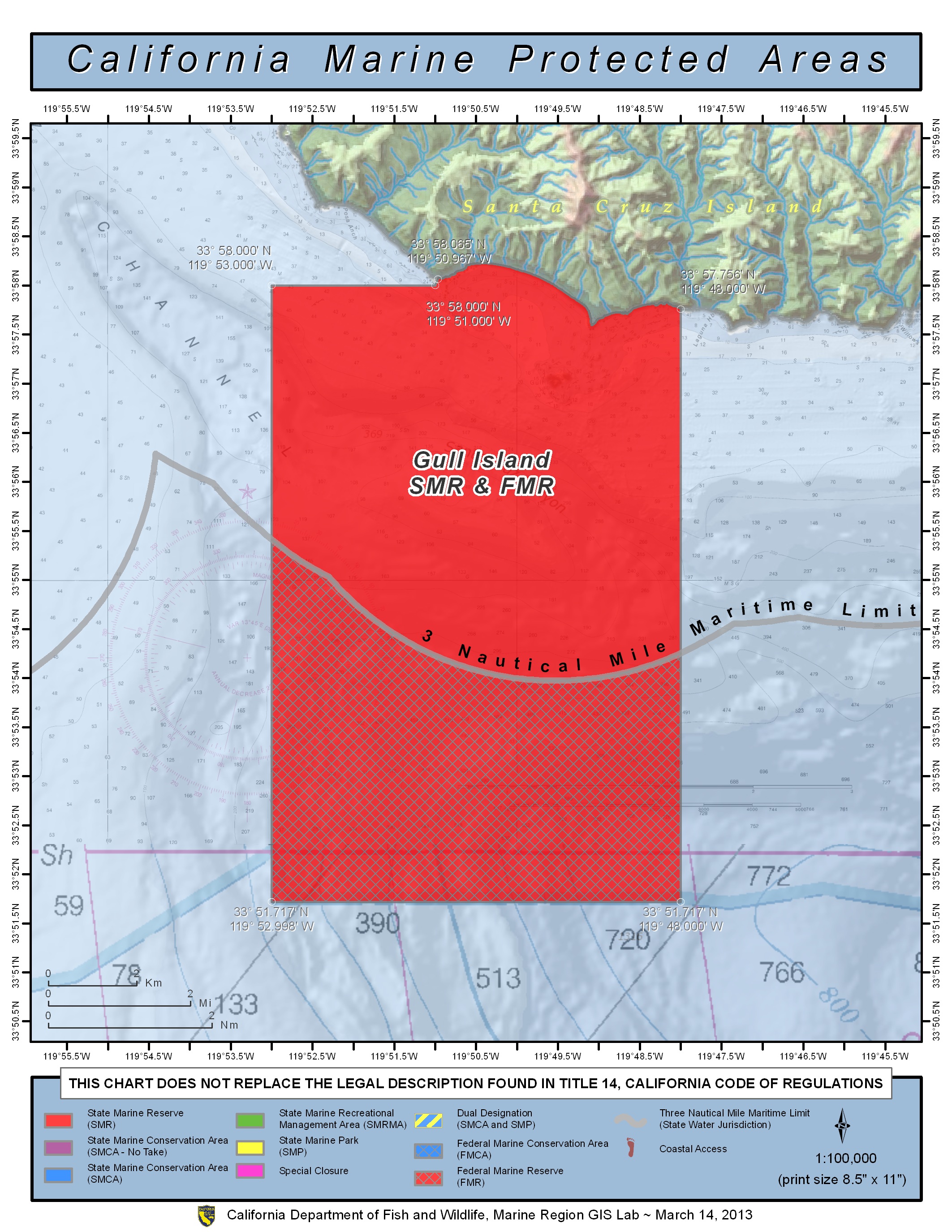
GPS Boundary:
This area is bounded by the mean high tide line and straight lines connecting the following points in the order listed except where noted:
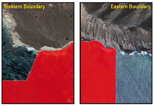
33° 58.065’N. lat. 119° 50.967’W. long.;
33° 58.000’N. lat. 119° 51.000’W. long.;
33° 58.000’N. lat. 119° 53.000’W. long.;
33° 55.449’N. lat. 119° 53.000’W. long.;
thence eastward along the three nautical mile offshore boundary to
33° 54.257’N. lat. 119° 48.000’W. long.; and
33° 57.756’N. lat. 119° 48.000’W. long.
Federal MPA boundary corner coordinates
(Textual boundary descriptions and related regulations are available in the Federal Register 15 CFR Part 922 and 50 CFR Part 660).
33° 51.717′ N. lat., 119° 48.000′ W. long.
33° 51.717′ N. lat., 119° 53.000′ W. long.
33° 55.614′ N. lat., 119° 53.000′ W. long.
33° 54.420′ N. lat., 119° 48.000′ W. long.
Permitted/Prohibited Uses:
- Recreational Fishing:
- Allowed Species: None
- Prohibited Species: All
- Commercial Fishing:
- Allowed Species: None
- Prohibited Species: All
Effective as of: January 1, 2012