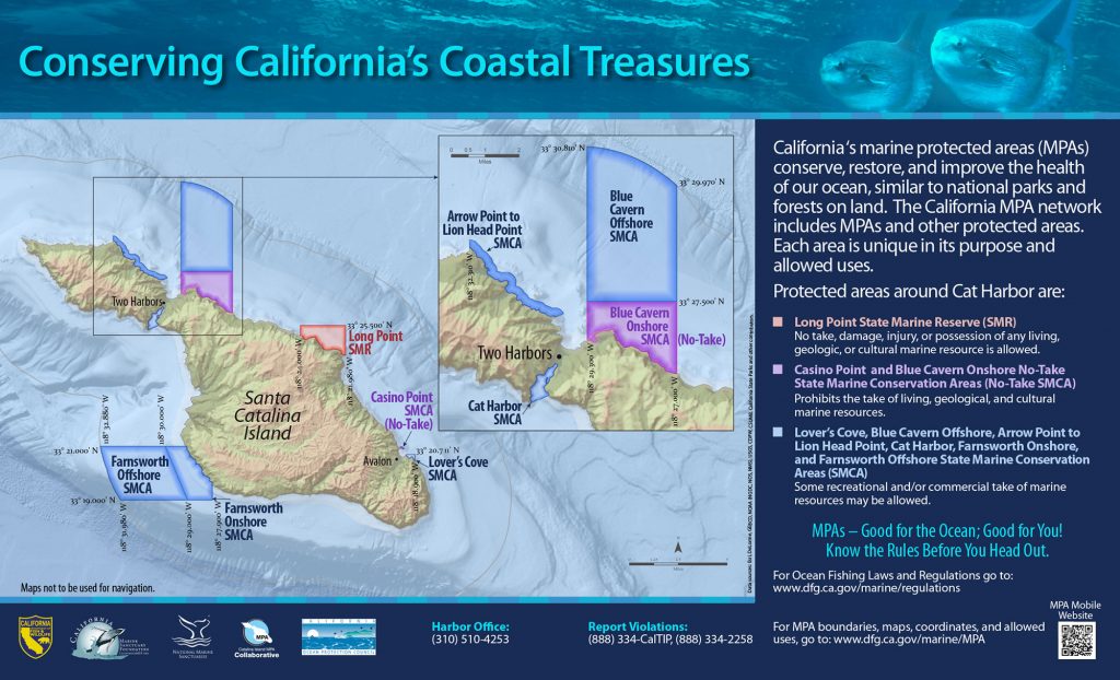
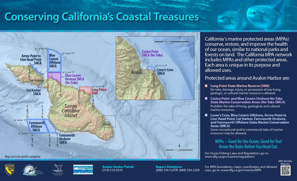
GPS Boundary:
This area is bounded by the mean high tide line and straight lines connecting the following points in the order listed:
33° 21.00′ N. lat. 118° 29.08′ W. long.;
33° 21.00′ N. lat. 118° 30.00′ W. long.;
33° 19.00′ N. lat. 118° 29.00′ W. long.;
33° 19.00′ N. lat. 118° 27.90′ W. long.; and
33° 19.56′ N. lat. 118° 27.90′ W. long.
Permitted/Prohibited Uses:
- Recreational Fishing:
- Allowed Species: White seabass and pelagic finfish by spearfishing; marlin, tunas, and dorado (dolphinfish) (Coryphaena hippurus) by trolling; and market squid by hand-held dip net.
- Prohibited Species: All other living marine resources EXCEPT those listed above.
- Commercial Fishing:
- Allowed Species: Swordfish by harpoon; and coastal pelagic species by round haul net, brail gear, and light boat. Not more than five percent by weight of any commercial coastal pelagic species catch landed or possessed shall be other incidentally taken species.
- Prohibited Species: All other living marine resources EXCEPT those listed above.
Effective as of: January 1, 2012