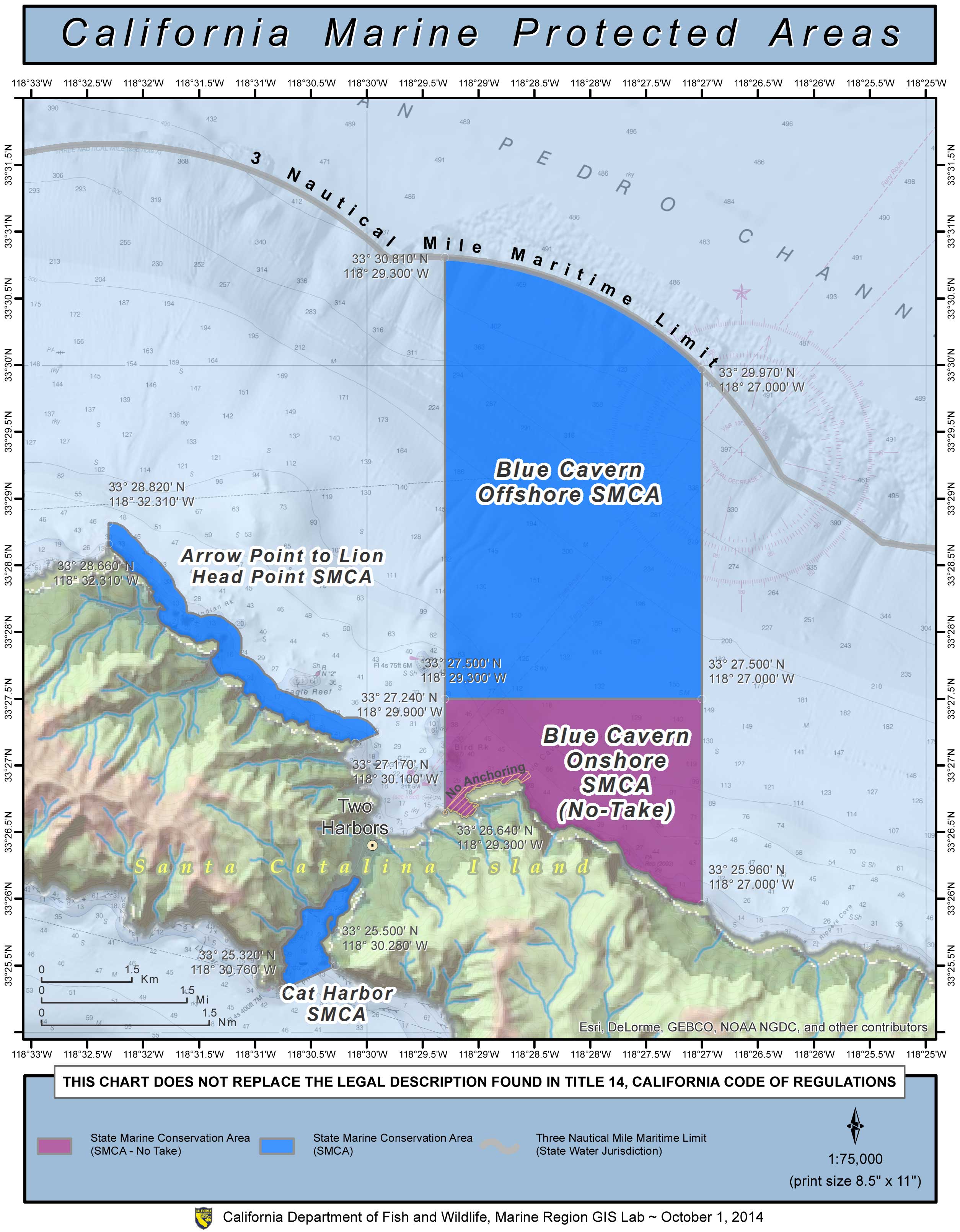
GPS Boundary:
This area is bounded by the mean high tide line and straight lines connecting the following points in the order listed:
33° 25.96′ N. lat. 118° 27.00′ W. long.;
33° 27.50′ N. lat. 118° 27.00′ W. long.;
33° 27.50′ N. lat. 118° 29.30′ W. long.; and
33° 26.64′ N. lat. 118° 29.30′ W. long.
Permitted/Prohibited Uses:
- Recreational Fishing:
- Allowed Species: None
- Prohibited Species: All
- Commercial Fishing:
- Allowed Species: None
- Prohibited Species: All
- Other Regulations:
- Except as pursuant to Federal law, emergency caused by hazardous weather, or as provided in this section, it is unlawful to anchor or moor a vessel in the Blue Cavern State Marine Conservation Area. The director of the Blue Cavern State Marine Conservation Area, or any person that the director of the conservation area has authorized may anchor or moor a vessel or take, for scientific purposes, any fish or specimen of marine life under the conditions prescribed in a scientific collecting permit issued by the department.
Effective as of: January 1, 2012
