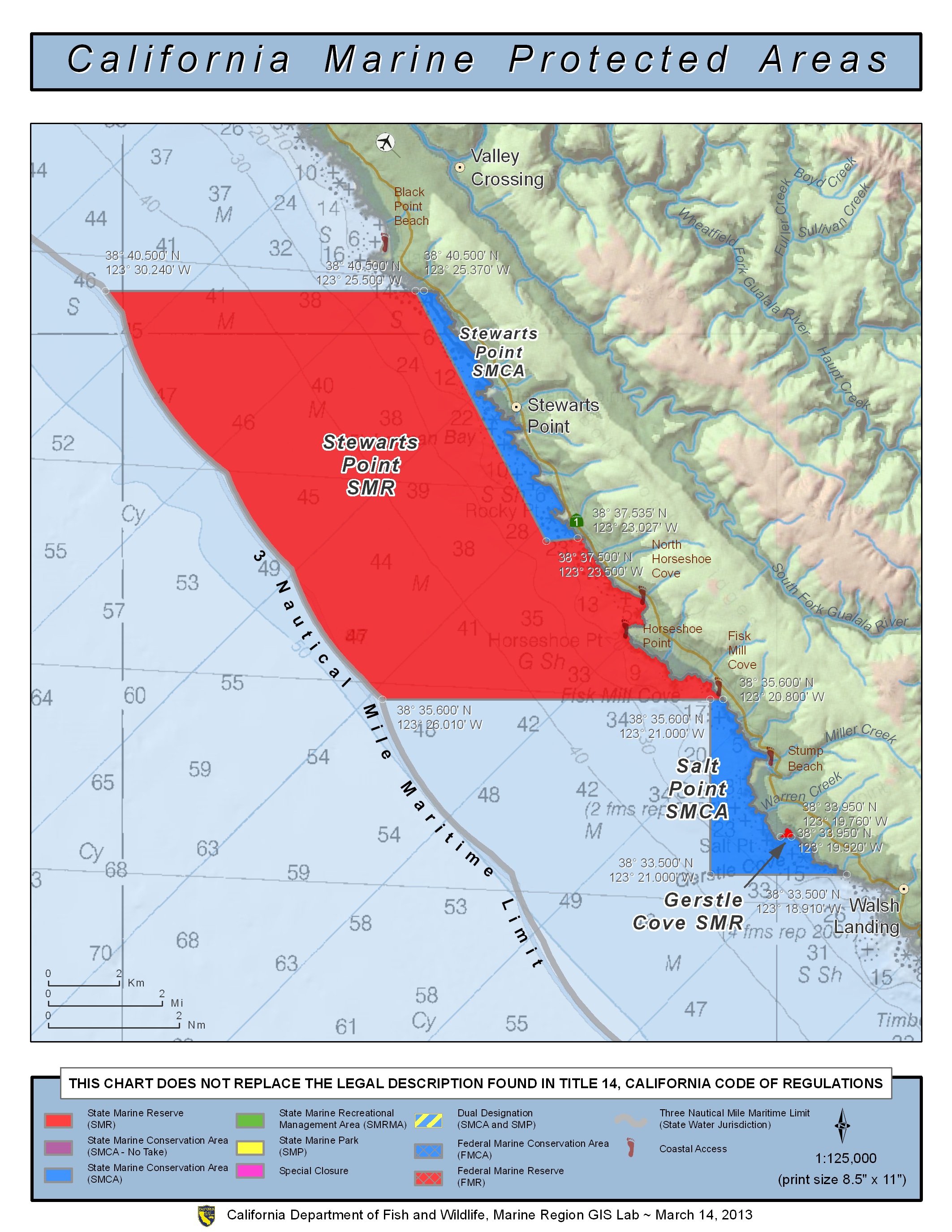
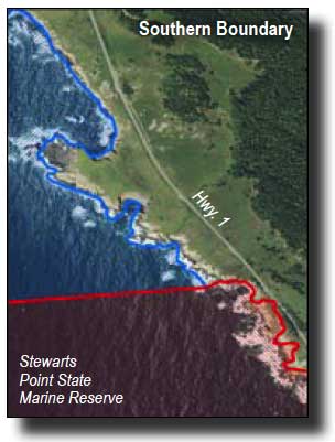
Shoreline Boundary Landmarks:
Coming soon!
GPS Boundary:
This area is bounded by the mean high tide line and straight lines connecting the following points in the order listed:
38° 40.500′ N. lat. 123° 25.370′ W. long.;
38° 40.500′ N. lat. 123° 25.500′ W. long.;
38° 37.500′ N. lat. 123° 23.500′ W. long.; and
38° 37.535′ N. lat. 123° 23.027′ W. long.
Permitted/Prohibited Uses:
- Recreational Fishing:
- Allowed Species: From shore only: marine aquatic plants other than sea palm, marine invertebrates, finfish by hook-and-line, surf smelt by beach net, and species authorized in Section 28.80 by handheld dip net.
- Prohibited Species: All other living marine resources EXCEPT those listed above.
- Commercial Fishing:
- Allowed Species: None
- Prohibited Species: All
- Definitions:
- Finfish are defined as any species of bony fish or cartilaginous fish (sharks, skates and rays). Finfish do not include amphibians, invertebrates, plants or algae.
Effective as of: May 1, 2010
Additional Resources:
- Brochure: Del Mar Brochure
- Interpretive Panels: