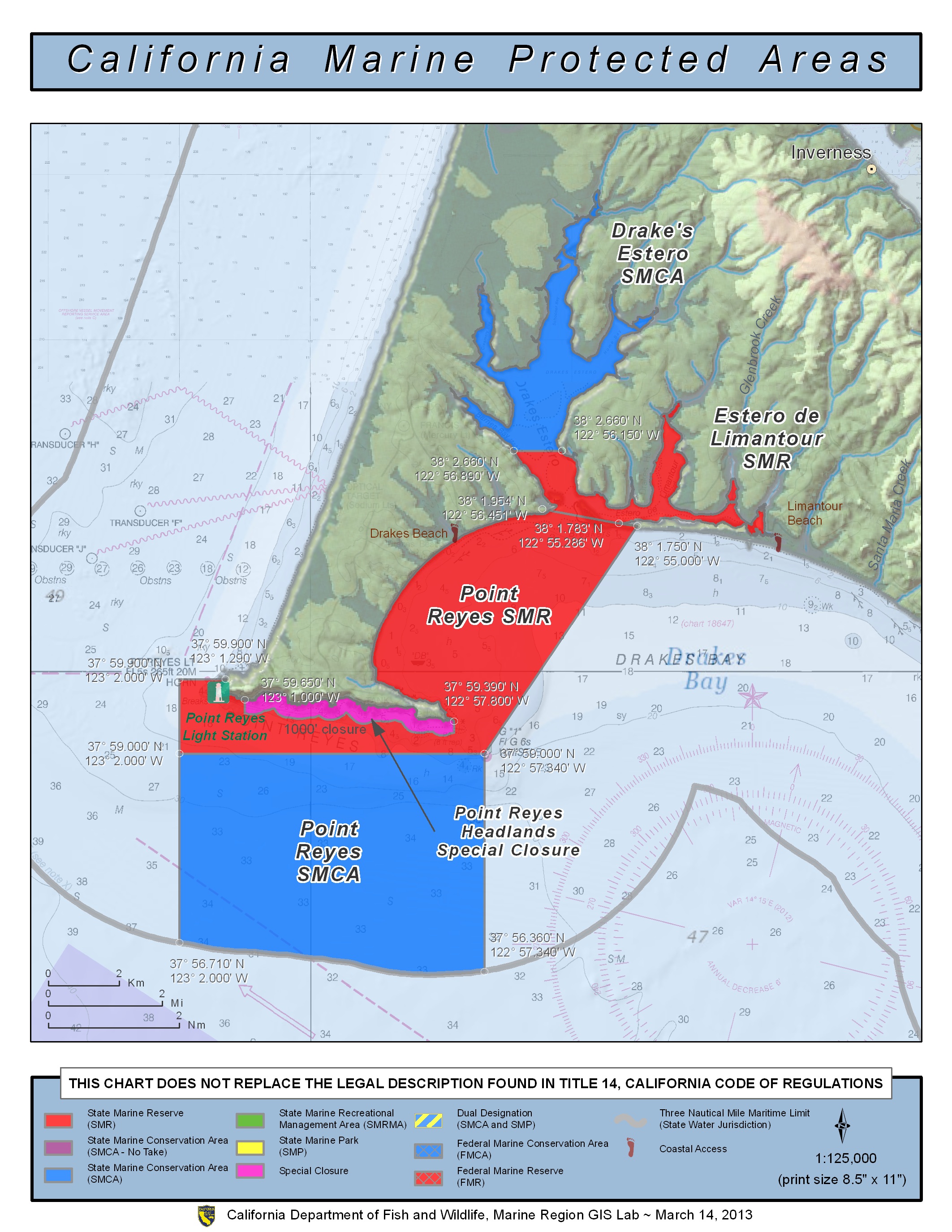
GPS Boundary:
This area is bounded by the mean high tide line and straight lines connecting the following points in the order listed:
37° 59.90′ N. lat. 123° 01.29′ W. long.;
37° 59.90′ N. lat. 123° 02.00′ W. long.;
37° 59.00′ N. lat. 123° 02.00′ W. long.;
37° 59.00′ N. lat. 123° 02.00′ W. long.;
37° 59.00′ N. lat. 122° 57.34′ W. long.; and
38° 01.75′ N. lat. 122° 55.00′ W. long.; thence westward along the mean high tide line onshore boundary to
38° 01.783′ N. lat. 122° 55.286′ W. long.; and
38° 01.954′ N. lat. 122° 56.451′ W. long.
Permitted/Prohibited Uses:
- Recreational Fishing:
- Allowed Species: None
- Prohibited Species: All
- Commercial Fishing:
- Allowed Species: None
- Prohibited Species: All
Effective as of: May 1, 2010
Additional Resources:
- Cool Facts: Visit Point Reyes
- Miller Boat Launch Sign
- Bodega Bay Harbor Brochure
- San Francisco Harbor Sign
- Exploring California’s Marine Protected Areas: Point Reyes State Marine Reserve (CDFW)