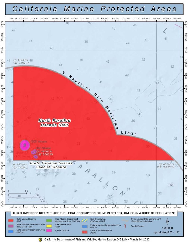
GPS Boundary:
Except as permitted by federal law or emergency caused by hazardous weather, no vessel shall be operated or anchored at any time from the mean high tide line to a distance of 1000 feet seaward of the mean lower low tide line of any shoreline of North Farallon Island, or to a distance of 300 feet seaward of the mean lower low tide line of any shoreline of the remaining three southern islets, including the Island of St. James, in the vicinity of 37° 46′ N. lat. 123° 06′ W. long.
Permitted/Prohibited Uses:
- Recreational Fishing
- Allowed Species: None
- Prohibited Species: All
- Commercial Fishing
- Allowed Species: None
- Prohibited Species: All
Other Regulations:
- No person shall enter the area, except for agencies identified in Title 14 Section 632 CCR, when performing their official duties.
- All vessels shall observe a five (5) nautical mile per hour speed limit within 1,000 feet seaward of the mean lower low tide line of any shoreline of the islets.
- ·In an area bounded by the mean high tide line and a distance of one nautical mile seaward of the mean lower low tide line of any of the four islets comprising the North Farallon Islands, the following restrictions apply:
- All commercial diving vessels operating in the defined area shall have their vessel engine exhaust system terminate either through a muffler for dry exhaust systems, or below the vessel waterline for wet exhaust systems.
- All commercial diving vessels equipped with an open, deck-mounted air compressor system, while operating in the defined area, shall have their air compressor’s engine exhaust system terminate below the vessel waterline.


