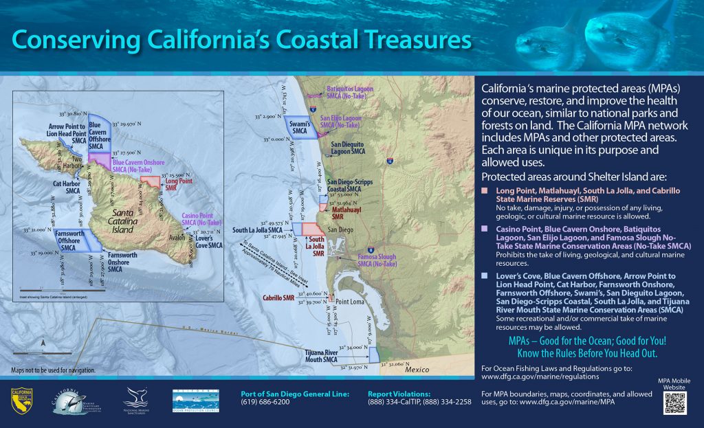
GPS Boundary:
This area is bounded by the mean high tide line and straight lines connecting the following points in the order listed:
32° 49.573′ N. lat. 117° 16.781′ W. long.;
32° 49.573′ N. lat. 117° 19.000′ W. long.;
32° 47.945′ N. lat. 117° 19.000′ W. long.; and
32° 47.945′ N. lat. 117° 15.495′ W. long.
Permitted/Prohibited Uses: *
- Recreational Fishing:
- Allowed Species: None
- Prohibited Species: All
- Commercial Fishing:
- Allowed Species: None
- Prohibited Species: All
Effective as of: January 1, 2012
Additional Resources:
- North BoundaryMarker Sign (631K PDF file) – from WILDCOAST
- South Boundary Marker Sign (631K PDF file)- from WILDCOAST
- Fishing Guide San Diego MPAs (346K PDF file)
- Marine Recreational Brochure San Diego MPAs (749K PDF file)
- San Diego Regional Map (3.5M PDF file)
- San Diego Harbor Sign
- Exploring California’s Marine Protected Areas: South La Jolla State Marine Reserve (CDFW)