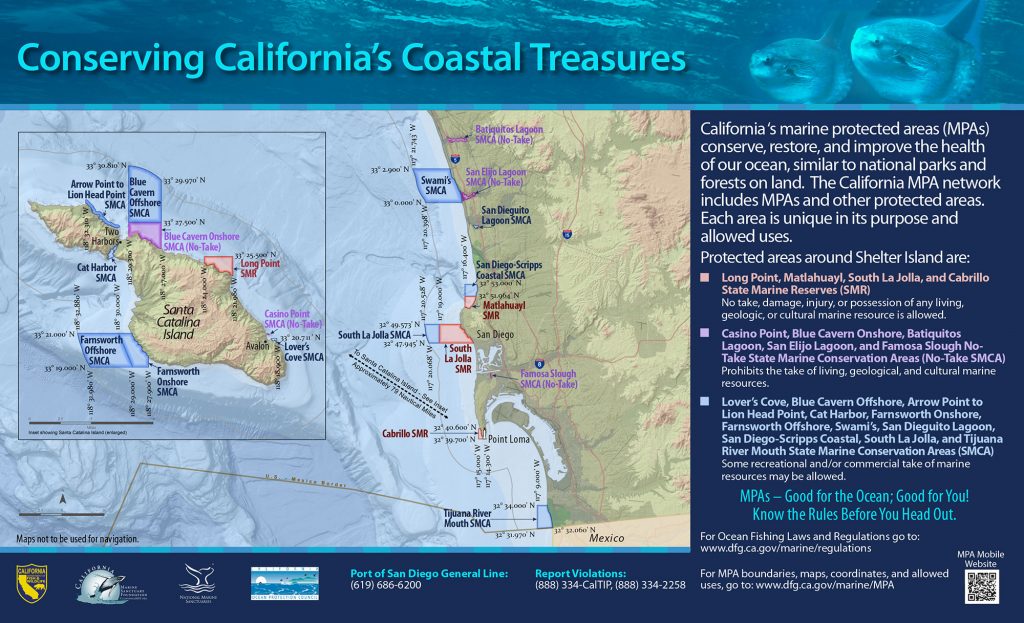
GPS Boundary:
This area is bounded by the mean high tide line and straight lines connecting the following points in the order listed:
32° 53.000′ N. lat. 117° 15.166′ W. long.;
32° 53.000′ N. lat. 117° 16.400′ W. long.;
32° 51.964′ N. lat. 117° 16.400′ W. long.; and
32° 51.964′ N. lat. 117° 15.233′ W. long.
Permitted/Prohibited Uses:
- Recreational Fishing:
- Allowed Species: Coastal pelagic species, except market squid, by hook-and-line only
- Prohibited Species: All other living marine resources EXCEPT those listed above.
- Commercial Fishing:
- Allowed Species: None
- Prohibited Species: All
- Other Regulations:
- Licensees of the Regents of the University of California and all officers, employees, and students of such university may take, for scientific purposes, invertebrates, fish, or specimens of marine plant or algae under the conditions prescribed in a scientific collecting permit issued by the department.
- Definitions:
- Coastal pelagic species means any of the following: northern anchovy (Engraulis mordax), Pacific sardine (Sardinops sagax), Pacific mackerel (Scomber japonicus), jack mackerel (Trachurus symmetricus), and market squid (Loligo opalescens).
Additional Resources:
- Fishing Guide San Diego MPAs (346K PDF file)
- Marine Recreational Brochure San Diego MPAs (749K PDF file)
- San Diego Regional Map (3.5M PDF file)
- San Diego Harbor Sign
Effective as of: January 1, 2012