Shoreline Boundary Landmarks:
Coming soon!
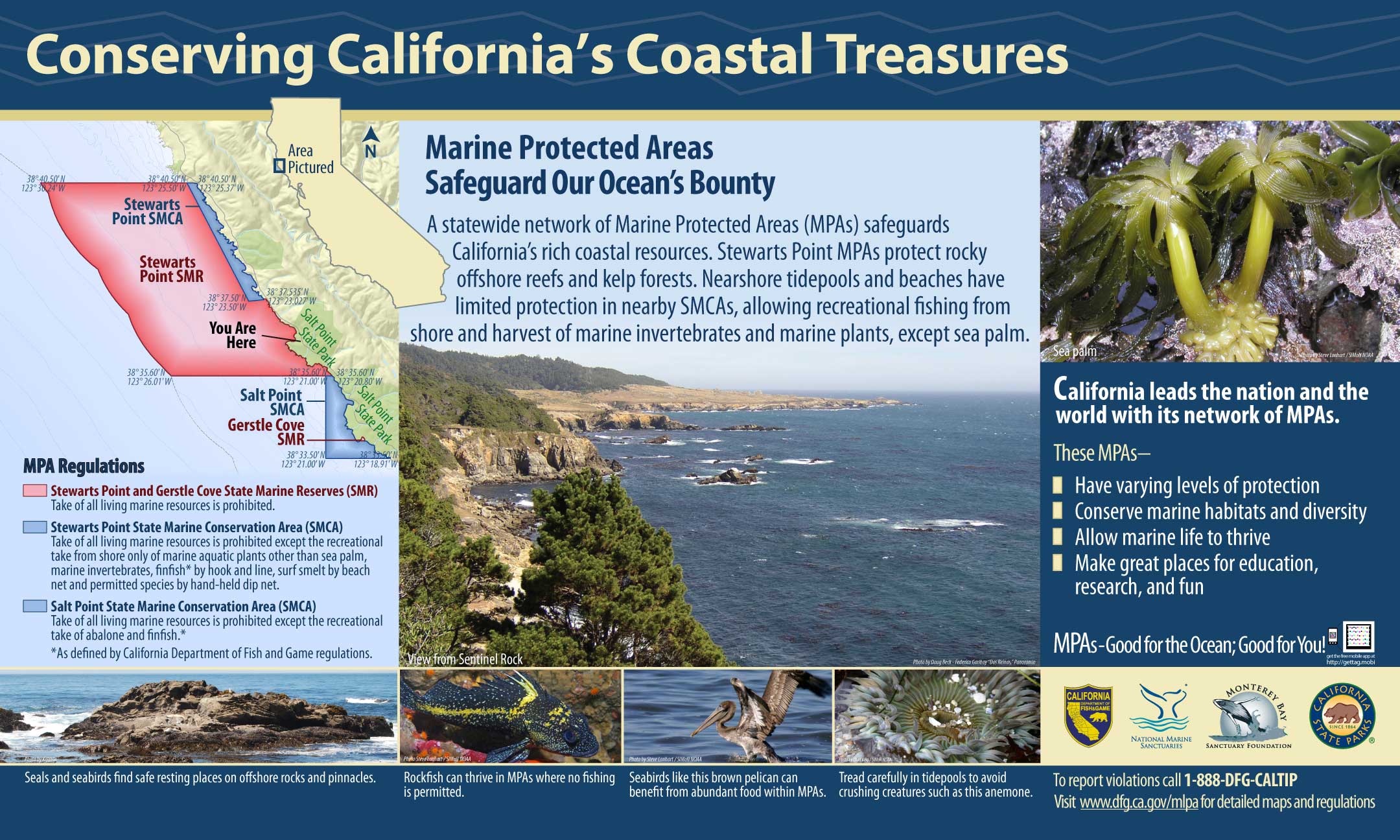
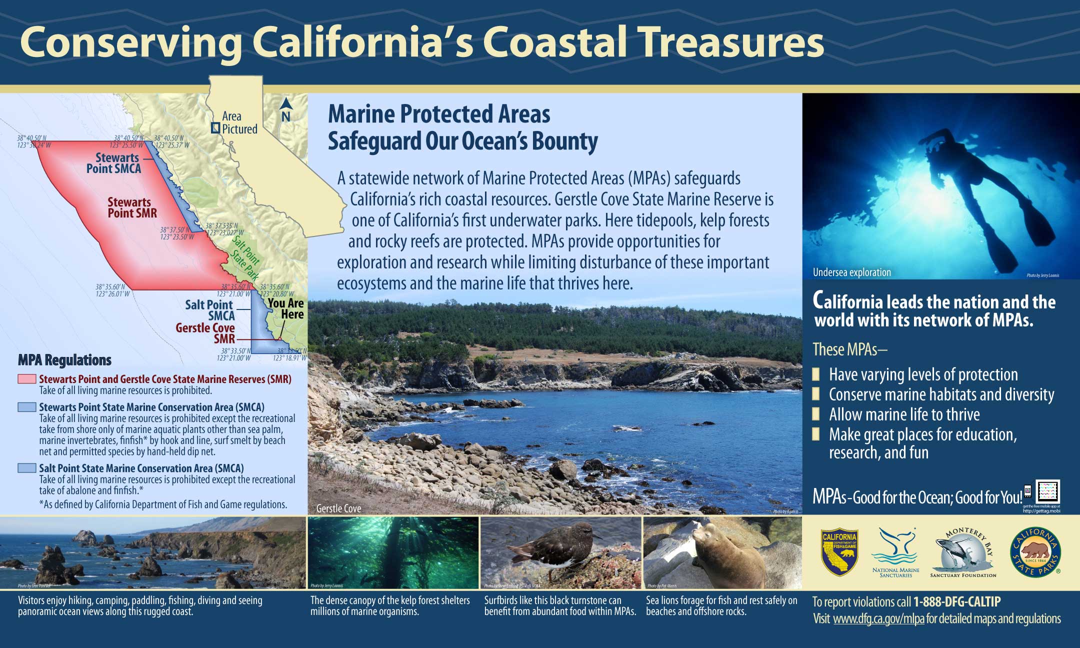
GPS Boundary:
This area is bounded by the mean high tide line and straight lines connecting the following points in the order listed:
38° 35.60′ N. lat. 123° 20.80′ W. long.;
38° 35.60′ N. lat. 123° 21.00′ W. long.;
38° 33.50′ N. lat.123° 21.00′ W. long.; and
38° 33.50′ N. lat. 123° 18.91′ W. long.,
except that Gerstle Cove as described in subsection 632(b)(13)(A) is excluded.
Permitted/Prohibited Uses:
- Recreational Fishing:
- Allowed Species: Abalone and finfish.
- Prohibited Species: All other living marine resources EXCEPT those listed above.
- Commercial Fishing:
- Allowed Species: None
- Prohibited Species: All
- Definitions:
- Finfish are defined as any species of bony fish or cartilaginous fish (sharks, skates and rays). Finfish do not include amphibians, invertebrates, plants or algae.
Effective as of: May 1, 2010
Additional Resources:
- Brochure: Del Mar Brochure
- Interpretive Panels:
- Cool Facts: Visit Salt Point