Shoreline Boundary Landmarks:
Coming soon!
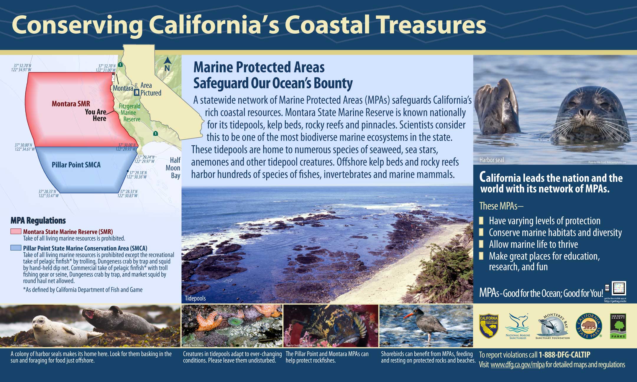
GPS Boundary:
This area is bounded by the mean high tide line and straight lines connecting the following points in the order listed except where noted:
37° 32.70′ N. lat. 122° 31.00′ W. long.;
37° 32.70′ N. lat. 122° 34.91′ W. long.;
thence southward along the three nautical mile offshore boundary to
37° 30.00′ N. lat. 122° 34.61′ W. long.; and
37° 30.00′ N. lat. 122° 29.93′ W. long.
Permitted/Prohibited Uses:
- Recreational Fishing:
- Allowed Species: None
- Prohibited Species: All
- Commercial Fishing:
- Allowed Species: None
- Prohibited Species: All
Effective as of: May 1, 2010
Additional Resources:
- Brochure: Montara Brochure
- Interpretive Panel: Fitzgerald Montara MPA
- Fitzgerald Marine Reserve self guided tour (1.5M PDF file)
- Cool Facts: Visit Montara
- Video: Fitzgerald Marine Reserve