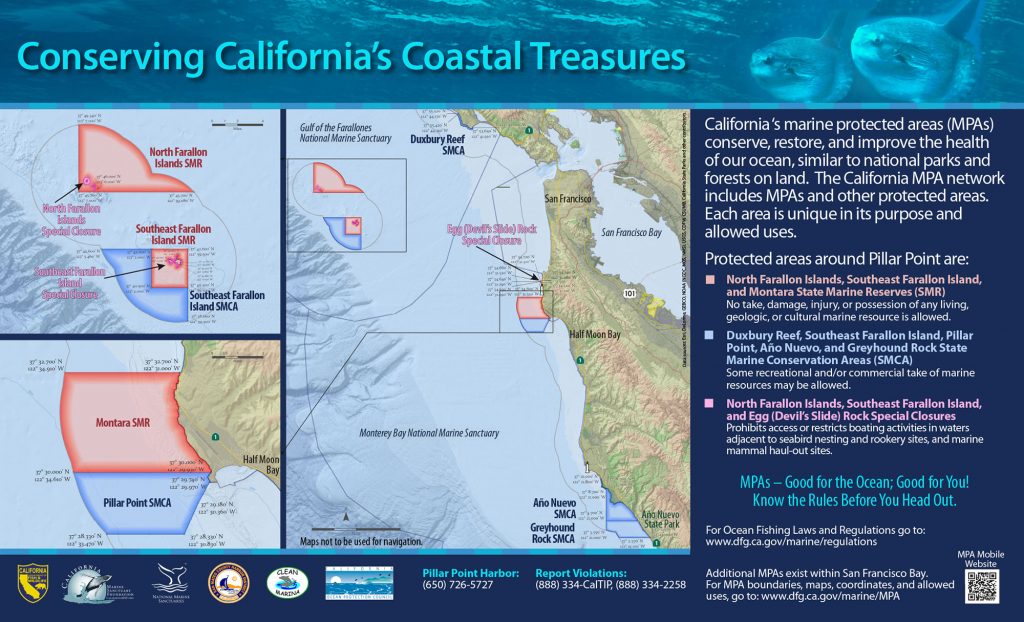
GPS Boundary:
From the mean high tide line to a distance of 300 feet seaward of the mean lower low tide line of any shoreline of any of the three rocks comprising Egg (Devil’s Slide) Rock, located in the vicinity of
37° 34.64′ N. lat. 122° 31.29′ W. long;
37° 34.66′ N. lat. 122° 31.32′ W. long; and
37° 34.63′ N. lat. 122° 31.29′ W. long;
and the area bounded by the mean high tide line and straight lines connecting the following points in the order listed:
37° 34.74′ N. lat. 122° 31.08′ W. long;
37° 34.72′ N. lat. 122° 31.31′ W. long;
37° 34.60′ N. lat. 122° 31.33′ W. long; and
37° 34.52′ N. lat. 122° 31.21′ W. long
Permitted/Prohibited Uses:
- Recreational Fishing
- Allowed Species: None
- Prohibited Species: All
- Commercial Fishing
- Allowed Species: None
- Prohibited Species: All
Other Regulations:
- Transit in between the rock and the mainland between these points is prohibited at any time.
- No person shall enter the area, except for agencies identified in Title 14 Section 632 CCR, when performing their official duties.
