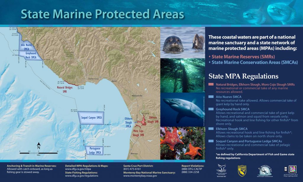
Shoreline Boundary Landmarks:
Extends from the north side of Greyhound Rock in the north to the northern edge of Scott Creek Beach in the south.
GPS Boundary:
This area is bounded by the mean high tide line, the three nautical mile offshore boundary and straight lines connecting the following points in the order listed except where noted:
37° 04.70′ N. lat. 122° 16.20′ W. long.;
37° 04.70′ N. lat. 122° 21.00′ W. long.;
37° 03.55′ N. lat. 122° 21.00′ W. long.;
thence southward along the three nautical mile offshore boundary to
37° 02.57′ N. lat. 122° 19.10′ W. long.; and
37° 02.57′ N. lat. 122° 14.00′ W. long.
Permitted/Prohibited Uses:
- Recreational Fishing:
- Allowed Species: Giant kelp (Macrocystis pyrifera) by hand, market squid, salmon, and by hook-and-line from shore only, other finfish.
- Prohibited Species: All other living marine resources EXCEPT those listed above.
- Commercial Fishing:
- Allowed Species: Giant kelp (Macrocystis pyrifera) by hand harvest only, salmon, and market squid. Not more than five percent by weight of any commercial market squid catch landed or possessed shall be other incidentally taken species.
- Prohibited Species: All other living marine resources EXCEPT those listed above.
- Definitions:
- Finfish are defined as any species of bony fish or cartilaginous fish (sharks, skates and rays). Finfish do not include amphibians, invertebrates, plants or algae.
Additional Resources:
Effective as of: September 21, 2007