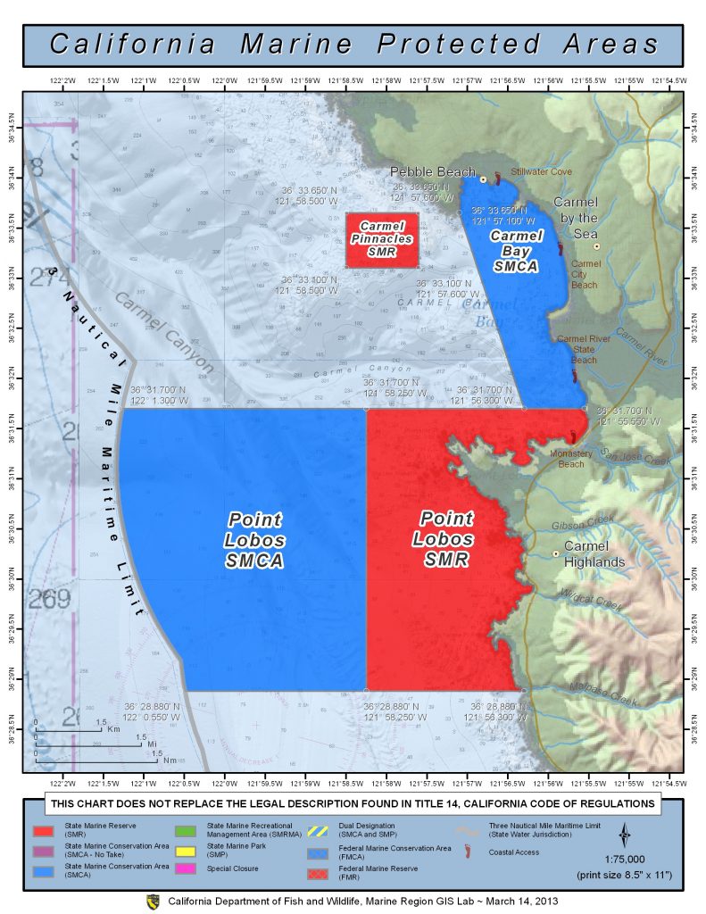
Shoreline Boundary Landmarks:
Extends from Pescadero Point in Stillwater Cove on the north to the rocky point on the north side of Monastery Beach on the south.
GPS Boundary:
This area is bounded by the mean high tide line and straight lines connecting the following points in the order listed:
36° 33.65′ N. lat. 121° 57.10′ W. long.;
36° 31.70′ N. lat. 121° 56.30′ W. long.; and
36° 31.70′ N. lat. 121° 55.55′ W. long.
Permitted/Prohibited Uses:
- Recreational Fishing:
- Allowed Species: Finfish
- Prohibited Species: All other living marine resources EXCEPT those listed above.
- Commercial Fishing:
- Allowed Species: Allowed Species: Giant kelp (Macrocystis pyrifera) and bull kelp (Nereocystis spp.) under the following conditions:
- Any individual kelp harvester with a valid permit issued pursuant to Section 165 may take no more than 44 tons of kelp from the portion of Administrative Kelp Bed 220 within the Pacific Grove Marine Gardens State Marine Conservation Area in any calendar month.
- Duplicate landing records must be kept on board the harvest vessel in accordance with the requirements of Section 165.
- Prohibited Species: All other living marine resources EXCEPT those listed above.
- Allowed Species: Allowed Species: Giant kelp (Macrocystis pyrifera) and bull kelp (Nereocystis spp.) under the following conditions:
- Definitions:
- Finfish are defined as any species of bony fish or cartilaginous fish (sharks, skates and rays). Finfish do not include amphibians, invertebrates, plants or algae.
Effective as of: September 21, 2007


