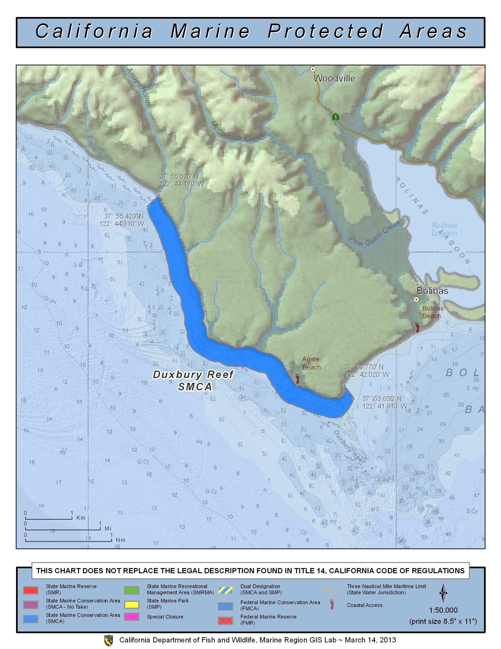
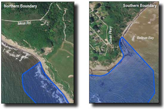
Shoreline Boundary Landmarks:
Coming soon!
GPS Boundary:
This area is bounded by the mean high tide line, a distance of 1000 feet seaward of mean lower low water, and the following points:
37° 55.52′ N. lat. 122° 44.17′ W. long.;
37° 55.42′ N. lat. 122° 44.31′ W. long.;
37° 53.65′ N. lat. 122° 41.91′ W. long.; and
37° 53.77′ N. lat. 122° 42.02′ W. long.
Permitted/Prohibited Uses:
- Recreational Fishing:
- Allowed Species: Finfish from shore only and abalone.
- Prohibited Species: All other living marine resources EXCEPT those listed above.
- Commercial Fishing:
- Allowed Species: None
- Prohibited Species: All
- Definitions:
- Finfish are defined as any species of bony fish or cartilaginous fish (sharks, skates and rays). Finfish do not include amphibians, invertebrates, plants or algae.
Effective as of: May 1, 2010