Shoreline Boundary Landmarks:
Coming soon!
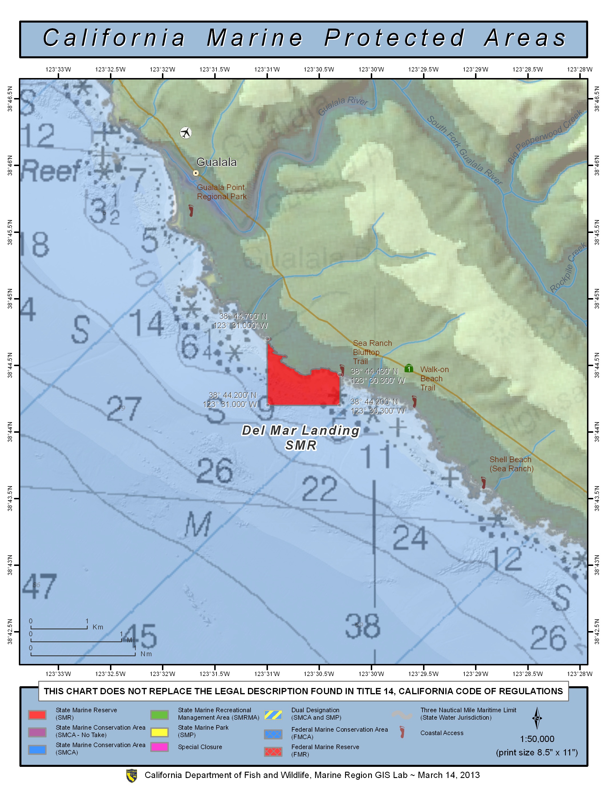
GPS Boundary:
This area is bounded by the mean high tide line and straight lines connecting the following points in the order listed:
38° 44.70′ N. lat. 123° 31.00′ W. long.;
38° 44.20′ N. lat. 123° 31.00′ W. long.;
38° 44.20′ N. lat. 123° 30.30′ W. long.; and
38° 44.43′ N. lat. 123° 30.30′ W. long.
Permitted/Prohibited Uses:
- Recreational Fishing:
- Allowed Species: None
- Prohibited Species: All
- Commercial Fishing:
- Allowed Species: None
- Prohibited Species: All
Effective as of: May 1, 2010
Additional Resources:
- Brochure: Del Mar Brochure